Junior Surveyors John Bessymon Koloth and Harvey Chapman-Lennon have joined Plowman Craven after completing their geospatial surveying course at Newcastle University in June 2026. Working across our Infrastructure and Property divisions, they will build on their university learning through practical experience, specialist training and opportunities to learn from colleagues across the business.
Starting a career in geospatial surveying means putting science, technology, engineering and mathematics into practice every day. From establishing accurate survey control to capturing detailed information about buildings and infrastructure, the profession connects technical knowledge with the places people live, work and travel.
For John and Harvey, that next stage is now underway at Plowman Craven. Their arrival brings fresh perspectives and additional surveying capability to two areas of the business, while giving them opportunities to explore how different teams apply their skills.
Building practical experience
John joins our Infrastructure division, where he will strengthen the core surveying capabilities of both the rail and utilities teams. Working alongside experienced colleagues will help him develop his practical skills and understand the different requirements of these environments.
Harvey joins Asset Management within our Property division. His early development will include learning best practice in data collection using SLAM scanners, building his understanding of how mobile mapping technology supports the capture of buildings and assets.
SLAM stands for simultaneous localisation and mapping. It allows a scanning system to build a map of its surroundings while determining its position within that environment. Using this technology effectively involves more than operating the equipment: planning the capture, understanding the surroundings and checking the resulting data are all essential parts of the process.
Although John and Harvey are joining different teams, a strong foundation in survey principles will support them both throughout their careers.
Understanding the fundamentals
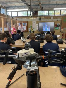
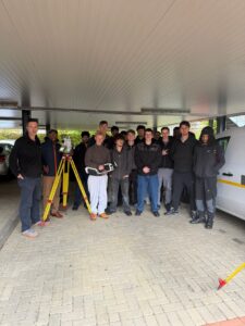
To help establish that foundation, Ross Macaulay, Head of Survey, delivered three days of introductory training covering survey theory, Plowman Craven’s workflows and practical demonstrations.
The programme connected the principles John and Harvey studied at university with the equipment, processes and decisions they will encounter on projects.
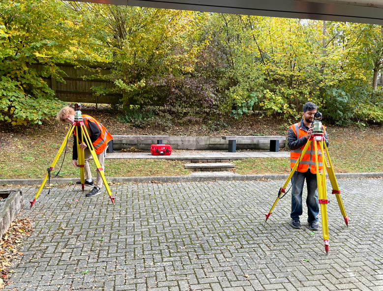
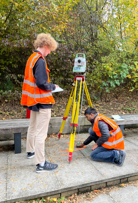
Around the office, they observed a survey traverse using a Leica TS16 total station. A traverse establishes a connected series of survey positions through measured angles and distances, providing a framework from which further measurements can be taken.
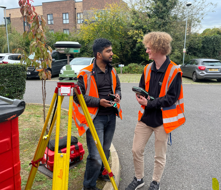
They also collected Global Navigation Satellite System (GNSS) data to establish station positions using satellite observations. Experiencing these methods together helped demonstrate how different measurement techniques contribute to a reliable survey framework.
Understanding that framework remains essential as surveying technology develops. Accurate data depends on the surveyor’s ability to select an appropriate method, recognise potential sources of error and assess whether the results meet the project’s requirements.
Exploring capture technology
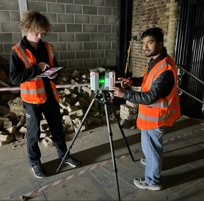
The training continued in London, where John and Harvey visited a project site and assisted a surveyor using an RTC scanner. They were also introduced to the Leica P40 laser scanner and NavVis MLX mobile mapping system.
This gave them an early opportunity to see a range of data capture technologies and consider how equipment choices relate to the environment being surveyed and the information a client needs.
For someone entering the profession, exposure to different systems helps connect the complete surveying process: planning the work, collecting measurements, checking quality and producing useful information.
It also reinforces the importance of professional judgement. Equipment can make data collection faster and more flexible, but understanding how to use it appropriately remains central to achieving dependable results.
Developing STEM careers
John and Harvey’s arrival highlights the role geospatial surveying can play in turning STEM education into a practical career.
Mathematics underpins measurement and positioning. Scientific understanding helps surveyors assess accuracy and uncertainty. Engineering knowledge provides context for the assets being measured, while technology enables increasingly detailed ways to capture and interpret the physical world.
Alongside those technical abilities, surveyors need clear communication, teamwork and problem-solving skills. Working across disciplines helps early-career professionals understand how their contribution fits into a wider project, from initial site investigations through to the management of existing assets.
The importance of developing this workforce is also reflected in government policy. The Government’s £625 million Construction Skills Package aims to support the training of up to 60,000 additional skilled construction workers. In a June 2026 parliamentary response, the Government also highlighted higher and degree apprenticeships, including the chartered surveyor route, as pathways into professional and technical built environment roles.
For geospatial businesses, structured workplace learning helps connect education with the practical demands of delivering projects. Giving new surveyors access to experienced colleagues, varied assignments and different technologies helps them develop both technical confidence and an understanding of the industry.
Growing through collaboration
Ross’s ambition is for both John and Harvey to feel welcomed, progress within the business and seek opportunities to work with different teams as their experience grows.
That breadth matters. Exposure to different projects, environments and surveying methods can help them keep their skills fresh, develop their judgement and discover where their strengths and interests lie.
Working across teams also encourages the exchange of knowledge. New colleagues bring recent academic learning and fresh questions, while experienced surveyors share the practical insights gained through years of project delivery.
We look forward to supporting John and Harvey as they take these next steps and begin making their own contribution to projects across Plowman Craven.
For STEM-related enquiries, including educational visits and opportunities to introduce students to geospatial surveying, please contact Ross Macaulay, Head of Survey, at [email protected].