Lovell Telescope 

Include an engaging summary hook that gives the reader a sense of the project and entices them to read on.

Digitally preserving a symbol of British science.

The Lovell Telescope at Jodrell Bank Observatory is one of the world’s largest fully steerable radio telescopes and a globally recognised symbol of British scientific achievement. Operational since 1957 and now part of a UNESCO World Heritage Site, the structure required a comprehensive digital survey to support future works, research planning and long-term asset management. SDA Consulting LLP appointed Plowman Craven to deliver a full measured survey and BIM model of the telescope and surrounding site.

Client challenge.

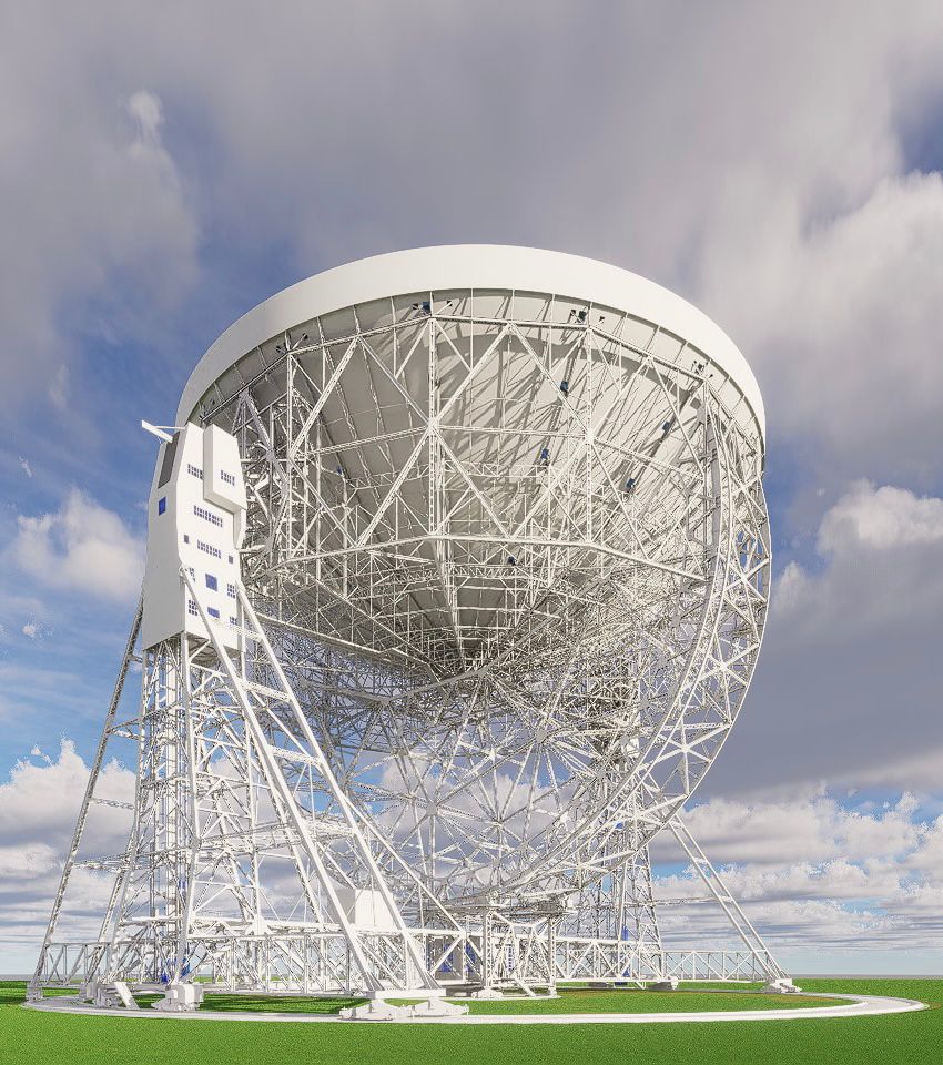
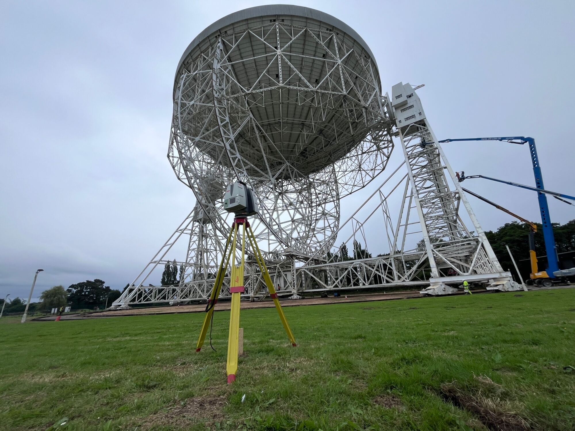
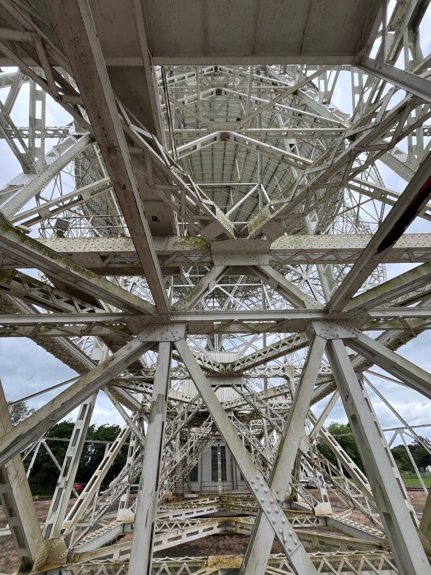
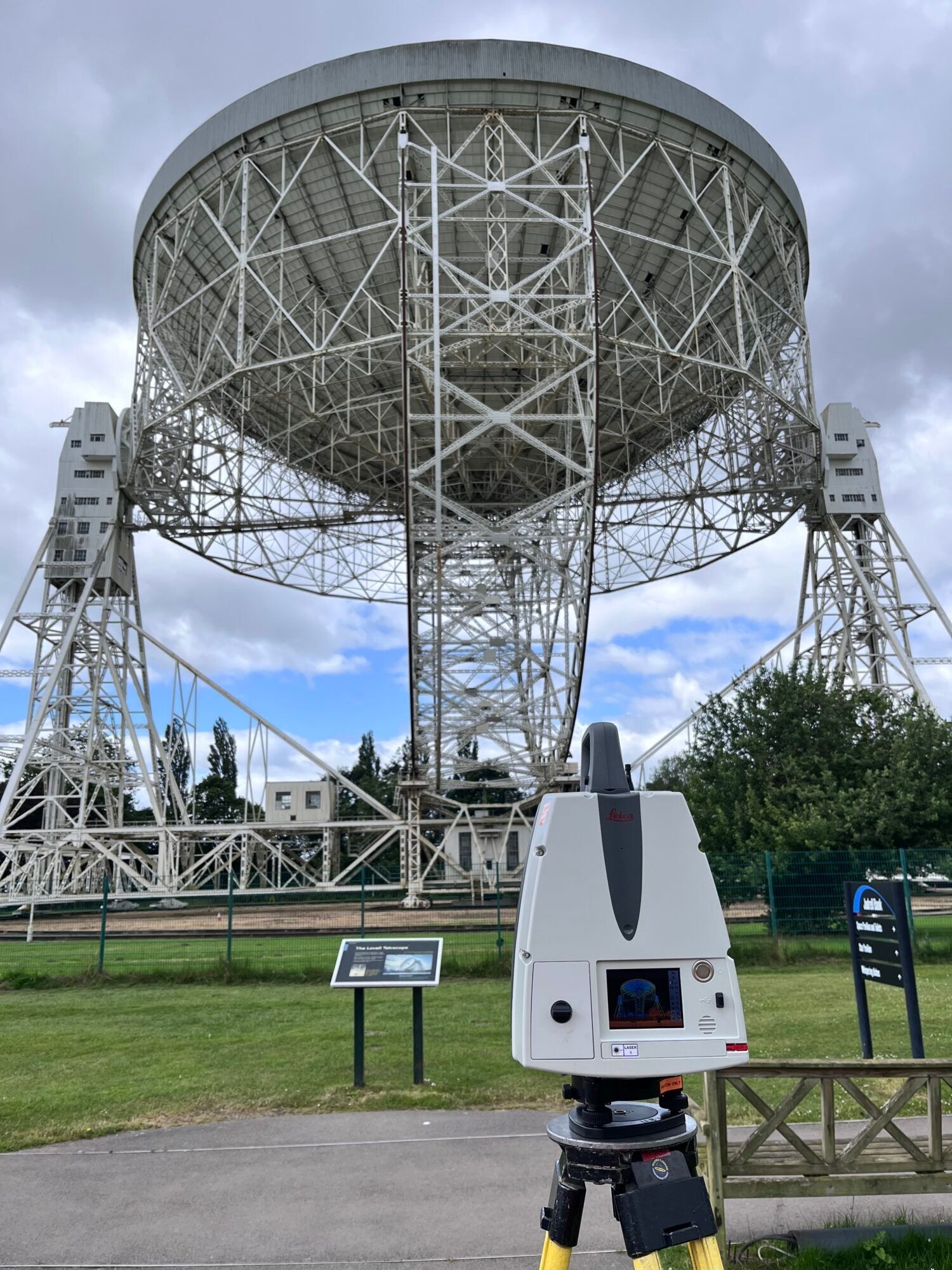
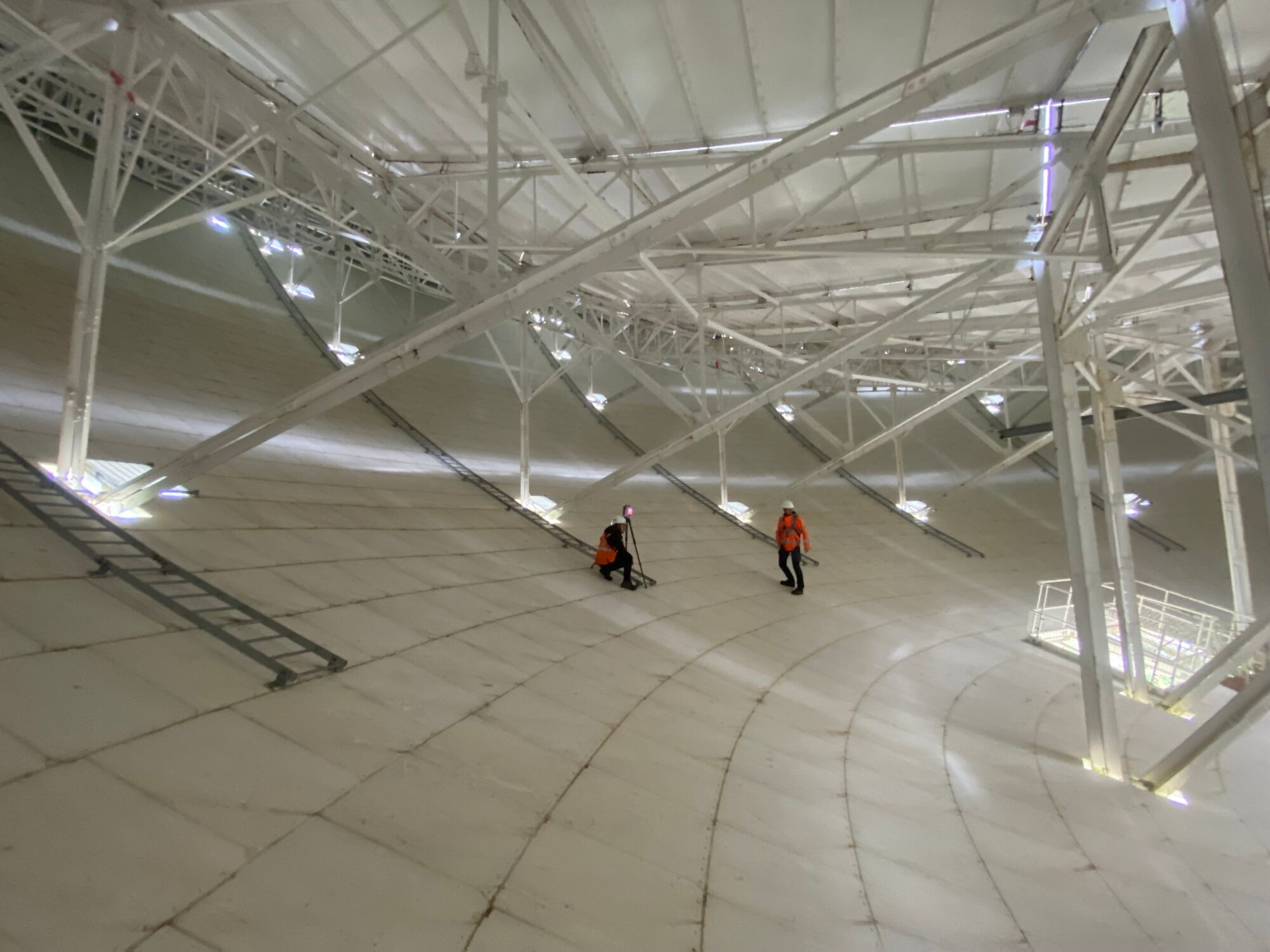
As a live UNESCO World Heritage Site and operational research facility, the Lovell Telescope required a precise and carefully managed surveying approach that protected ongoing activity and ensured the safe capture of complex geometry at height. 

The survey programme needed to: 

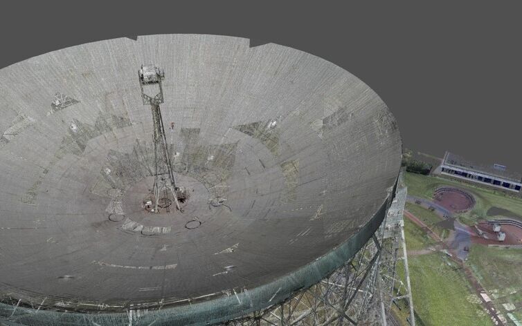
  • Capture the full external dish, support arms and structural frame, as well as internal rooms, lifts, platforms and control areas 
  • Operate safely at heights up to 90 metres, applying stringent access and H&S procedures 
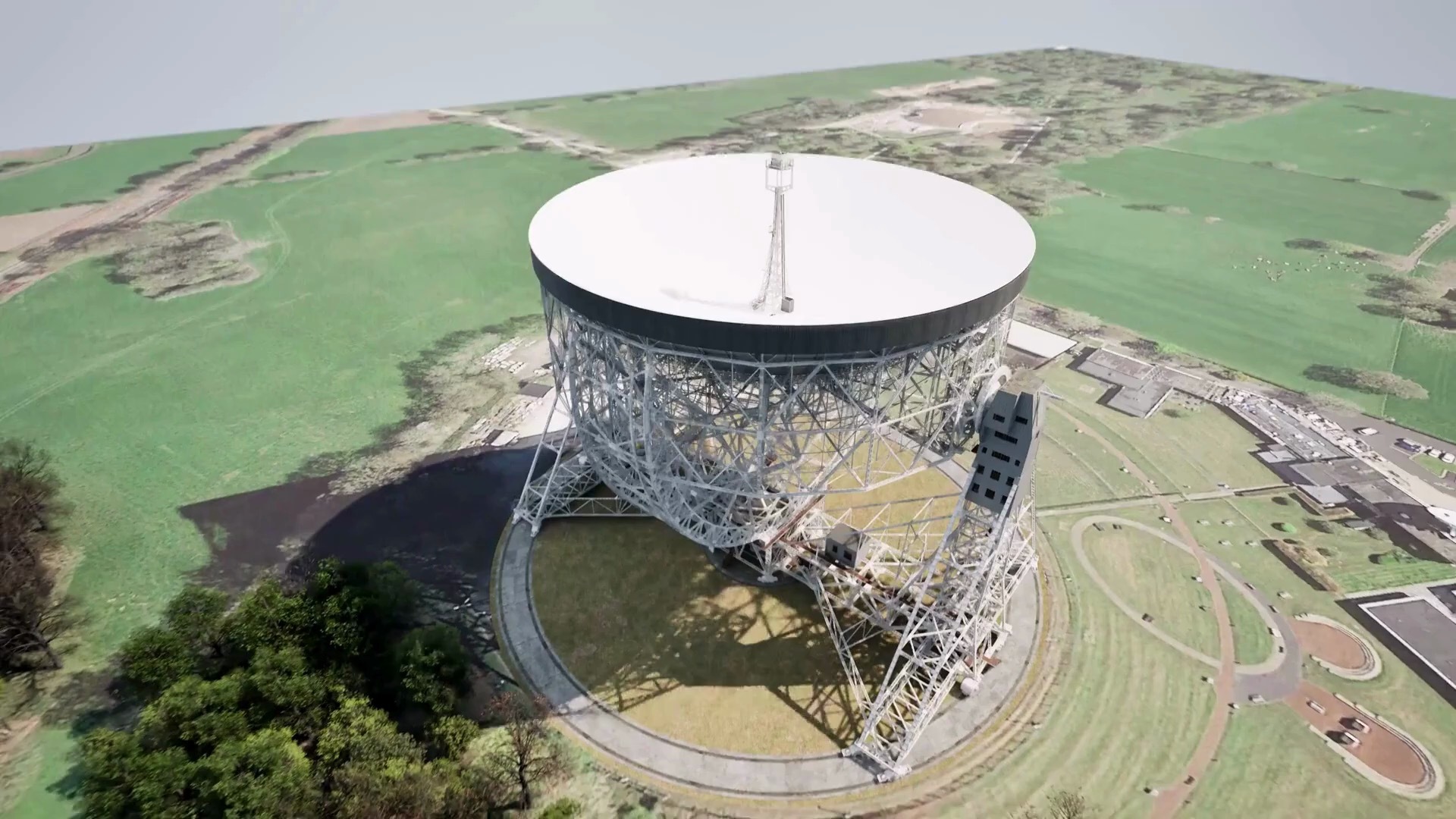
  • Produce geo-referenced data aligned to Ordnance Survey grid for future integration and planning 
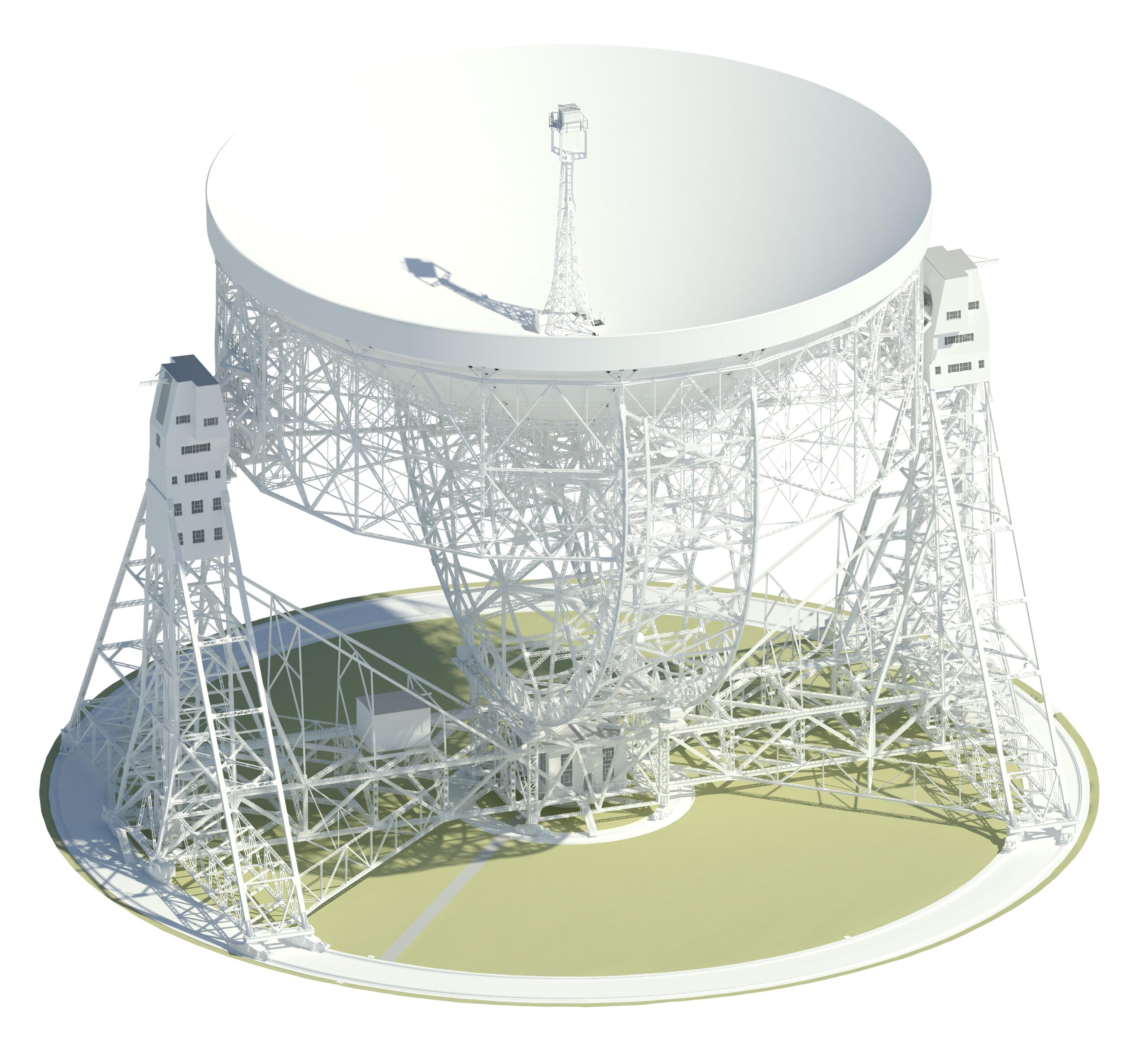
  • Deliver a Level of Detail (LOD) 2/3 BIM model for long-term planning, conservation and research support 
  • Provide detailed visual context to assist stakeholder understanding and future project coordination 

Scope of work included terrestrial laser scanning, topographical surveying, point cloud processing and alignment, Revit model production and 360-degree photography. 

Our
solution.

Plowman Craven applied a coordinated, safety-led surveying and modelling strategy tailored to the complexity of the structure and live research environment. 

Approach included: 

  • Laser scanning: High-resolution P40 and RTC scanning of the telescope’s dish, support arms, platforms and internal areas, capturing colour-enhanced point cloud data 
  • Topographical survey: Detailed mapping of the external site to ground the model in its true context 
  • Precise geo-referencing: Alignment of all datasets to the Ordnance Survey grid for positional accuracy and future integration 
  • LOD 2/3 Revit model: Creation of a detailed BIM model incorporating key structural and operating components 
  • 360-degree imagery: Immersive photography linked to model data to support design coordination and stakeholder review 

The methodology ensured compliance with stringent work-at-height requirements, safeguarded telescope operations and produced a fully coordinated digital data package. 

Project benefits.

This survey created a robust and future-ready digital record of an iconic scientific asset.
01

Precision data for planning and research

High-quality point clouds and a LOD 2/3 BIM model provide a reliable digital reference for future upgrades, conservation and academic use.
02

Safe delivery in a high-risk environment

Strict access planning and work-at-height protocols enabled safe data capture up to 90 m above ground level.
03

Efficient programme delivery

A structured methodology and specialist team enabled completion within the 12-week programme without disruption to observatory operations.

“A 'one-stop shop' for all surveying needs.“

“Plowman Craven’s expertise and ethos contributed to the success of our project, while the comprehensive nature of the deliverables will help to ensure Manchester University’s long-term needs can be met. Their ability to provide a ‘one-stop shop’ for all surveying needs made the process efficient and seamless, and we now have the essential data we need for planning applications moving forward.”

Jonathan Turner

Partner, SDA Consulting LLP

Project outcome.

Plowman Craven delivered a complete, highly accurate digital survey package for the Lovell Telescope, capturing the full external structure, internal spaces and surrounding site. The outputs include OS-aligned point clouds, a detailed LOD 2/3 Revit model and integrated 360-degree imagery, providing a single, authoritative digital reference for planning and asset management. This work gives SDA Consulting LLP and the University of Manchester confidence to progress future works, maintenance strategies and research planning with precision and minimal disruption to this internationally significant scientific facility. 

Want to see more of our work?

Know more. Risk less. At every stage.

With 60 years' experience providing clarity for complex, high stakes projects, we'll deliver the insight you need to build better.