Subsurface Mapping
& Investigation.

Critical insight beneath the surface to reduce risk.

Revealing the unseen to inform safe and efficient design.

Beneath every project lies information that determines its success. Plowman Craven provides complete understanding of subsurface conditions to help clients plan, design and build with confidence.

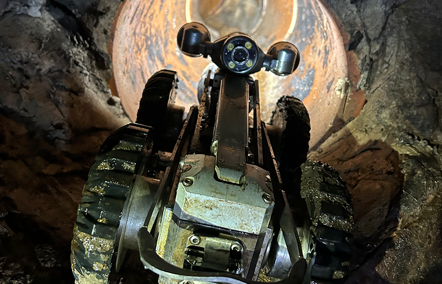
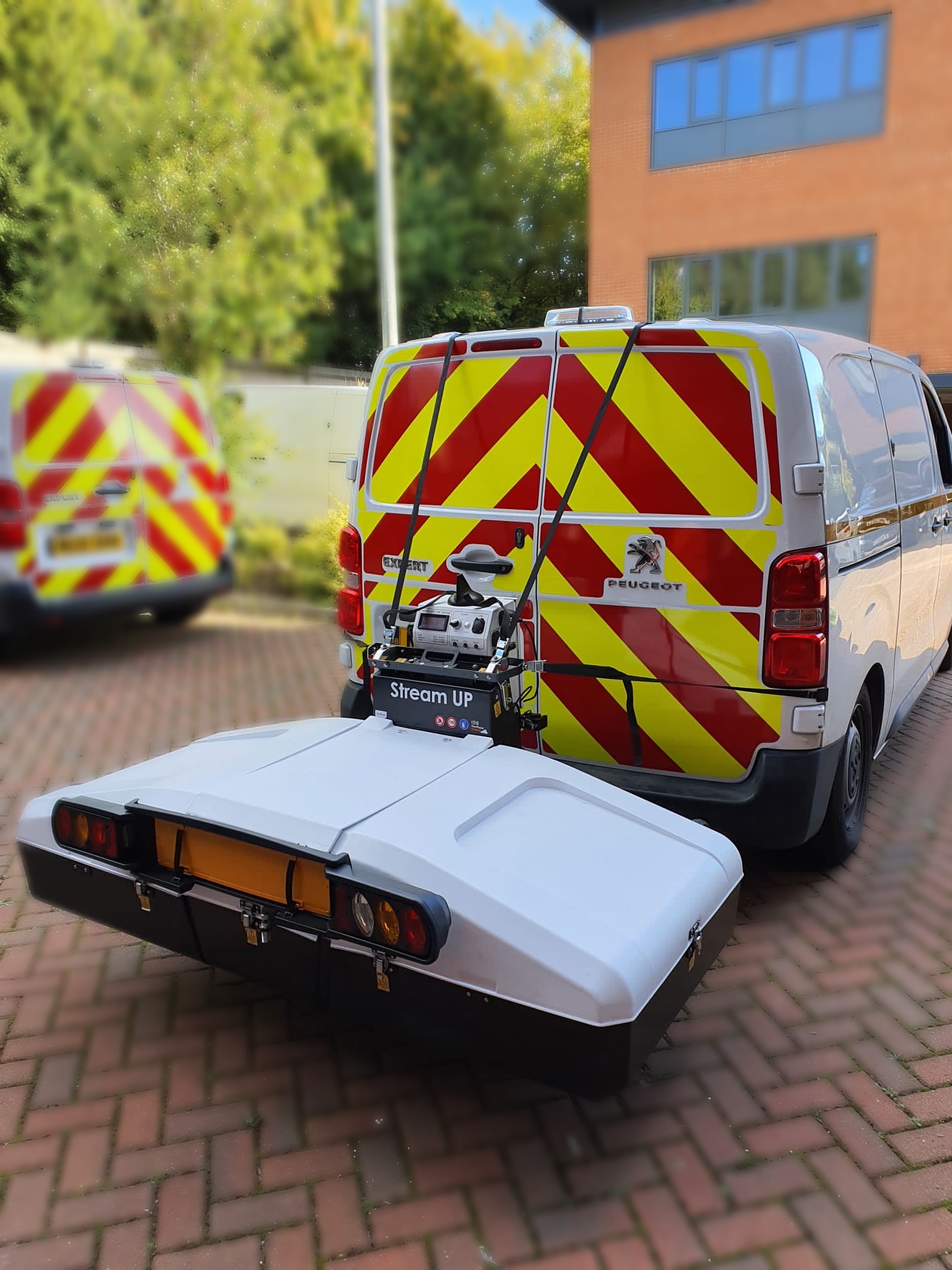
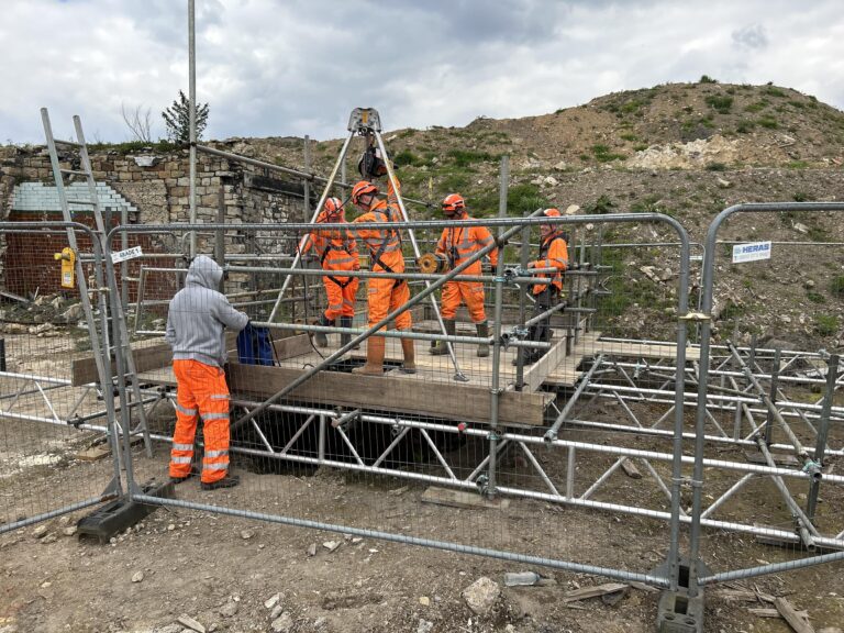
By locating, modeling and assessing underground assets and structures, we reduce uncertainty, prevent costly clashes and support safe, efficient delivery.

Our subsurface data connects seamlessly with wider site and design information, creating a clear digital foundation for confident decision-making.

Ground investigation support.

Accurate mapping that connects ground data to confident design.

Understanding ground conditions is essential for safe, efficient construction. Our Ground Investigation Support service precisely records and correlates boreholes, test pits and monitoring wells with utility and topographic data, reducing design errors, ground movement and delays. 

  • Record the location and elevation of boreholes, test pits and monitoring wells
  • Correlate findings with  utility mapping and topographical surveys
  • Support early design risk assessments and foundation planning
  • Provide data on soil composition and contamination
  • Enable safe and coordinated construction strategies

Utility surveys.

Accurate utility mapping to manage risk and support design.

Utility mapping is essential to risk management across the built environment. Our compliant surveys provide a clear understanding of buried utilities, preventing service strikes, protecting safety and supporting compliance. Integrated within digital models, this data also enables long-term asset tracking and maintenance.

  • Combine GPR, Electromagnetic Location (EML) and precise survey control
  • Produce outputs aligned with ASCE 38/ASCE 75 standards (Quality Levels B–A)
  • Support feasibility, design and construction planning
  • Reduce excavation risk and prevent costly program delays
  • Integrate with BIM and digital twin environments for asset visibility

Underground Geospatial Surveys (UGS).

Integrated subsurface mapping for complete project assurance.

Complex sites demand a single, coordinated view of what lies beneath. Our Underground Geospatial Surveys combine utility detection, CCTV and sewer surveys into one digital model, improving coordination, reducing risk and supporting efficient construction.

  • Combine multiple survey types into a structured deliverable
  • Support coordination between civil, structural and MEP disciplines
  • Enable informed design, construction planning and handover
  • Minimize service clashes, redesigns and program delays
  • Deliver verified data for digital twins and asset management

Sewer
surveys.

Condition and capacity insight for critical underground infrastructure.

Sewer networks play an essential role in public health and environmental protection. Our Sewer Surveys assess structural condition, capacity and connectivity to support compliance, maintenance planning and sustainable asset management. Early identification of issues prevents collapses, flooding and costly disruption.

  • Map sewer routes and record structural condition
  • Identify defects, blockages and capacity constraints
  • Support asset management and regulatory compliance
  • Provide data for maintenance and rehabilitation planning
  • Reduce environmental and operational risk through proactive inspection

CCTV
inspections.

Visual inspection for clarity and control below ground.

Our CCTV inspections use high-definition inspection to assess the condition and integrity of underground assets. Linking visual evidence to precise coordinates gives project teams confidence in drainage and service data before construction begins.

  • Capture georeferenced video inspections of drainage and conduits
  • Identify cracks, blockages and defects prior to excavation
  • Support design validation and pre-construction risk assessment
  • Provide accurate, documented evidence for compliance and handover
  • Integrate with ASCE and UGS deliverables for a complete subsurface record

Why work with us?

Trusted subsurface intelligence for safer, more predictable projects.

Plowman Craven combines decades of expertise with advanced digital workflows to deliver clarity where it matters most — below ground. Our Subsurface Mapping & Investigation services provide the insight and assurance needed to plan, design and build with confidence. 

How do our services help?

Project experience.

Our subsurface expertise supports major projects across transport, infrastructure and property, from complex redevelopments to critical public works.

Talk to our Subsurface Mapping specialists.