Locating Sub-Surface Infrastructure

Delivering a safe, high-precision survey of hidden drainage assets, enabling confident design and construction planning for a major new housing development.

Revealing the unseen to build with confidence.

A major new housing development in Greater Manchester will deliver nearly 300 homes, including new green spaces and a lake. Early in the development, the contractor required precise information on sub-surface drainage infrastructure, including the position and condition of a large underground brick culvert and two wells located beneath the site.

Plowman Craven’s in-house Utilities team was appointed to provide a comprehensive survey, combining laser scanning, CCTV inspection, and confined-space entry to capture accurate data for safe, informed design and construction planning.

Client challenge.

The site overlies historic drainage assets, including a brick culvert, two uncovered wells, and multiple lateral connections. Before works could proceed, the client required accurate data to: 

  • Confirm depth, alignment, and structural condition 
  • Ensure planned development would not compromise the drainage system 
  • Receive outputs in multiple formats to support design and stakeholder engagement 

Complex access conditions, fluctuating water levels, and active demolition works required rigorous planning, specialist confined-space expertise, and strict safety management. 

Our
solution.

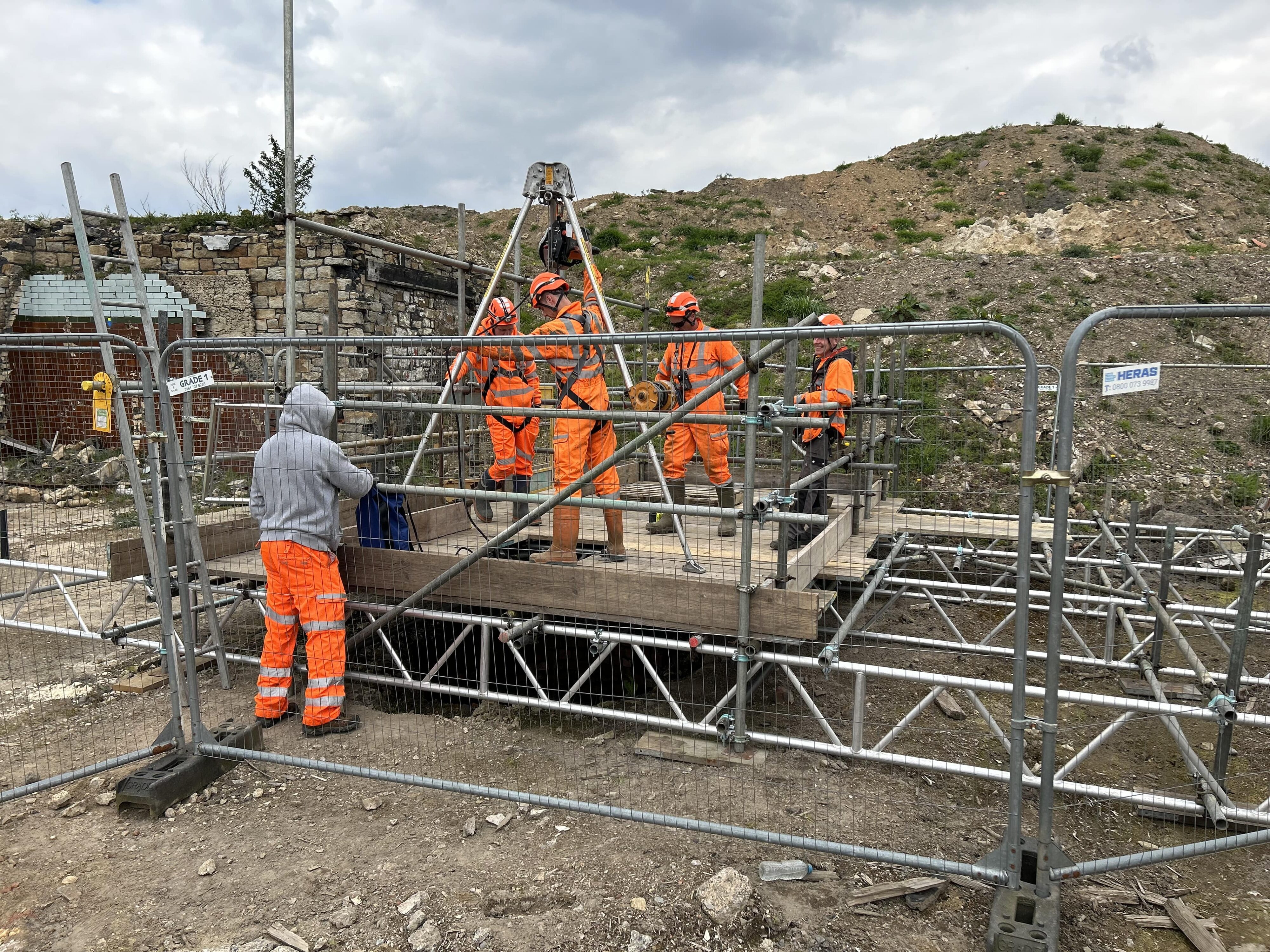
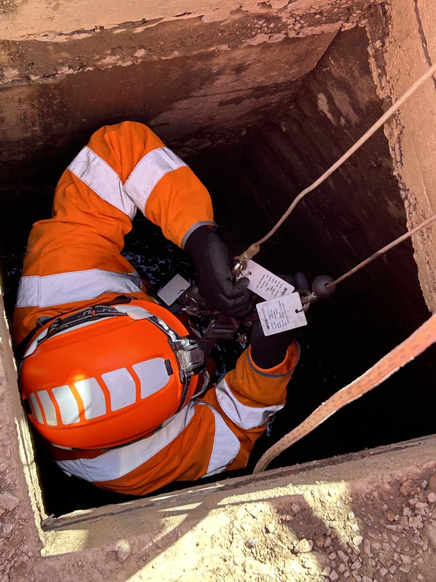
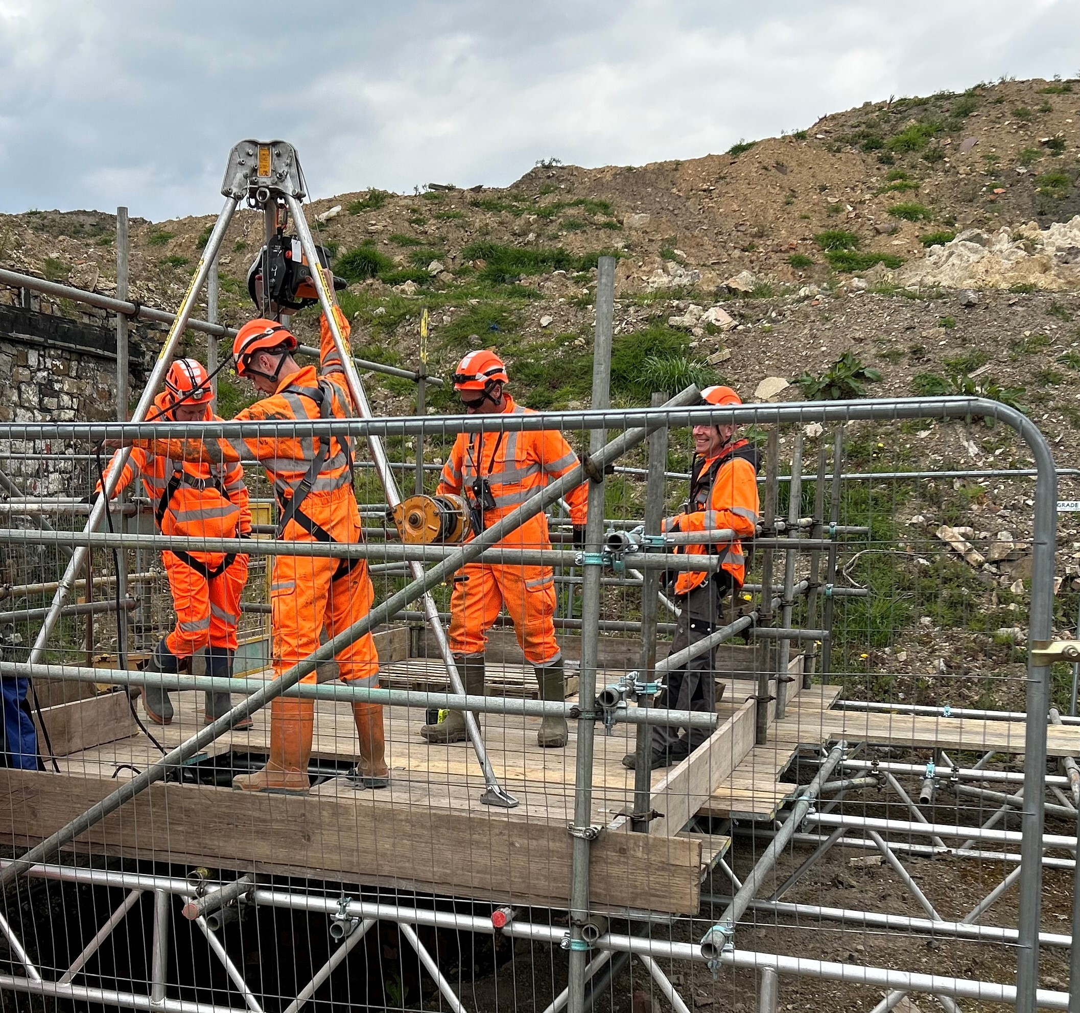
Plowman Craven delivered a Line and Level Correlation Survey, accessing the culvert via existing manholes using high-risk confined-space procedures managed in partnership with Redline Safety. 

 To ensure safe working in an active and potentially hazardous environment, the team implemented enhanced entry protocols, including continuous atmosphere and water-level monitoring, specialist rescue cover, and strict communication procedures. A bespoke scaffold platform and man-rider basket system enabled controlled descent into the wells, always ensuring full compliance with confined-space regulations and safe emergency egress. 

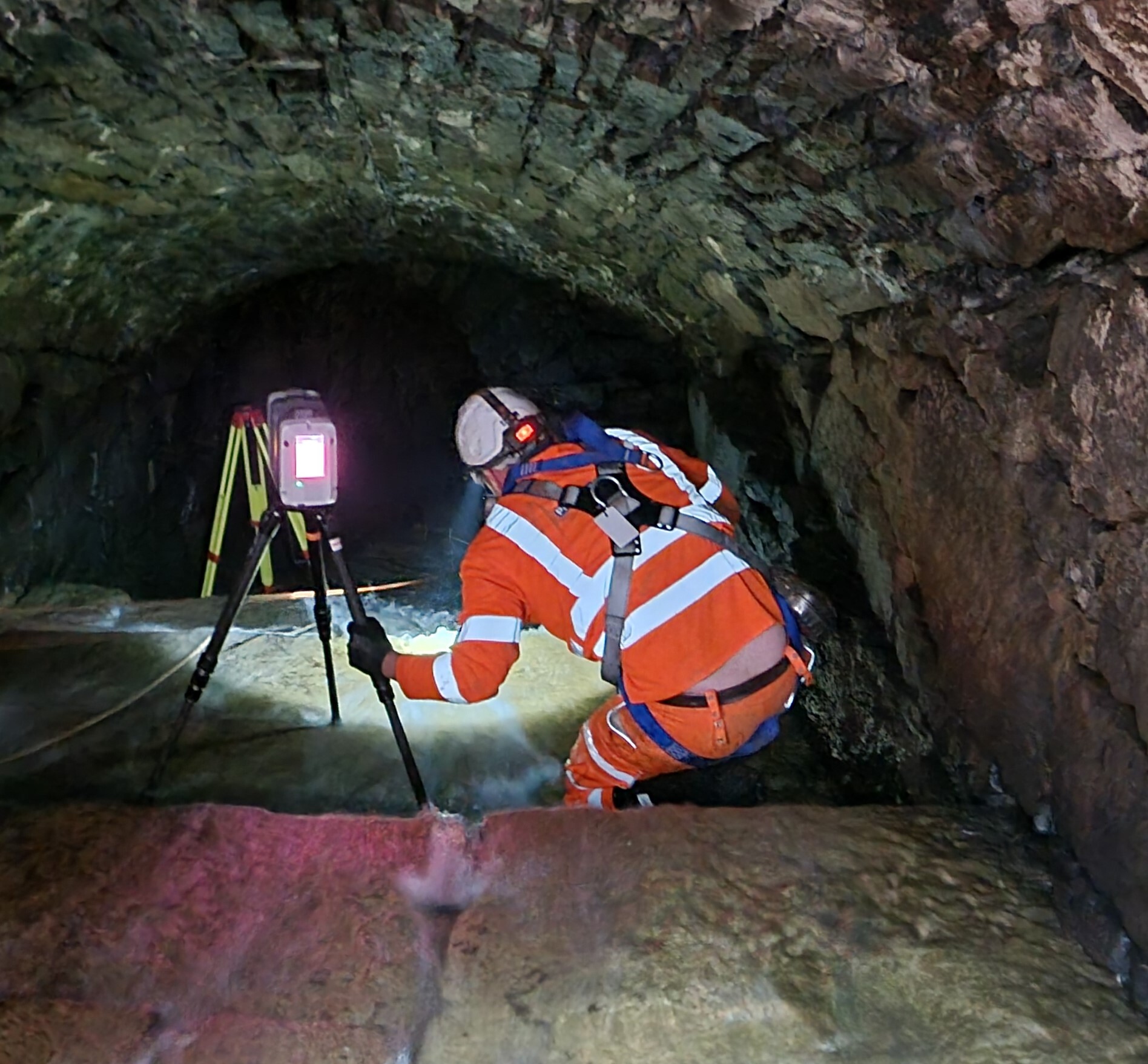
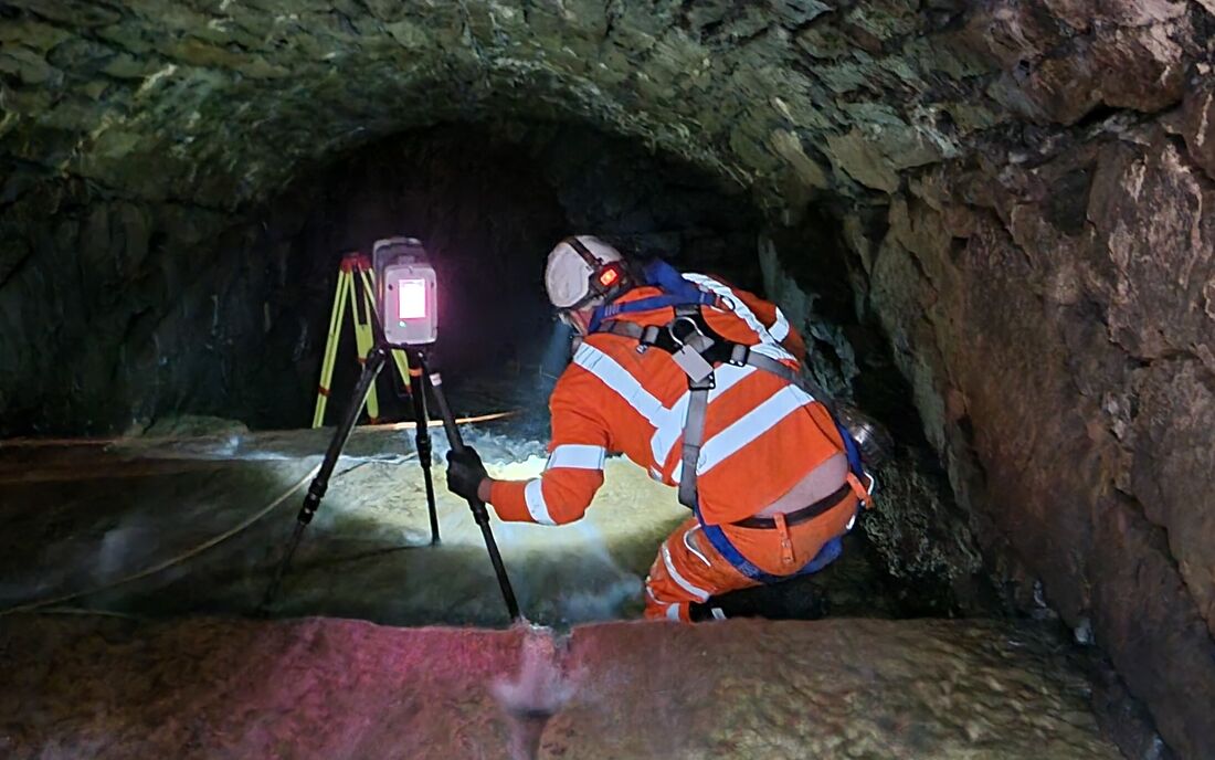
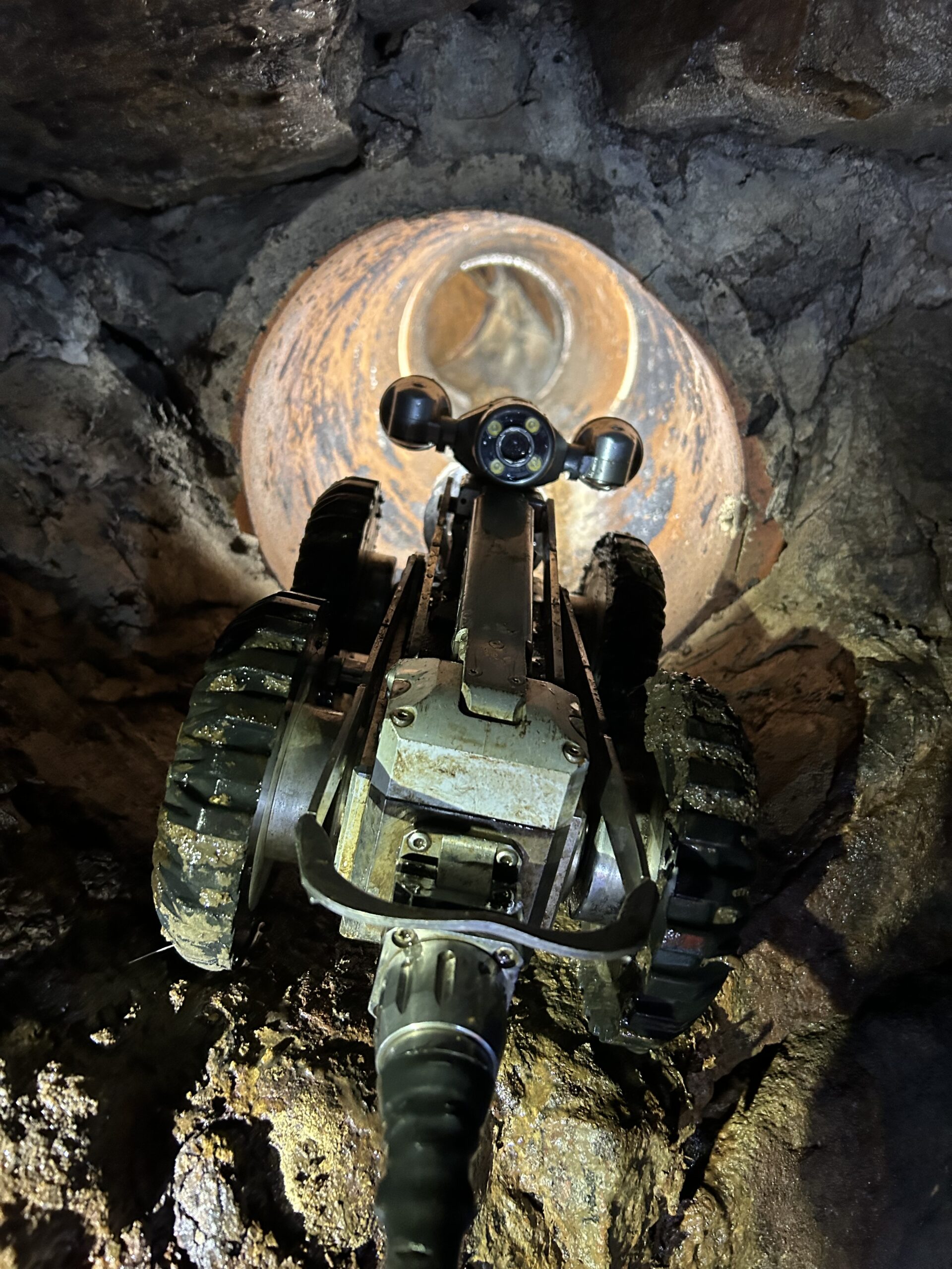
Once inside, the specialist team: 

  • Laser-scanned the culvert to capture high-resolution point cloud data 
  • Used CCTV crawler surveys to assess condition and identify defects 
  • Internally scanned two 15-metre-deep wells to confirm volume and connectivity 

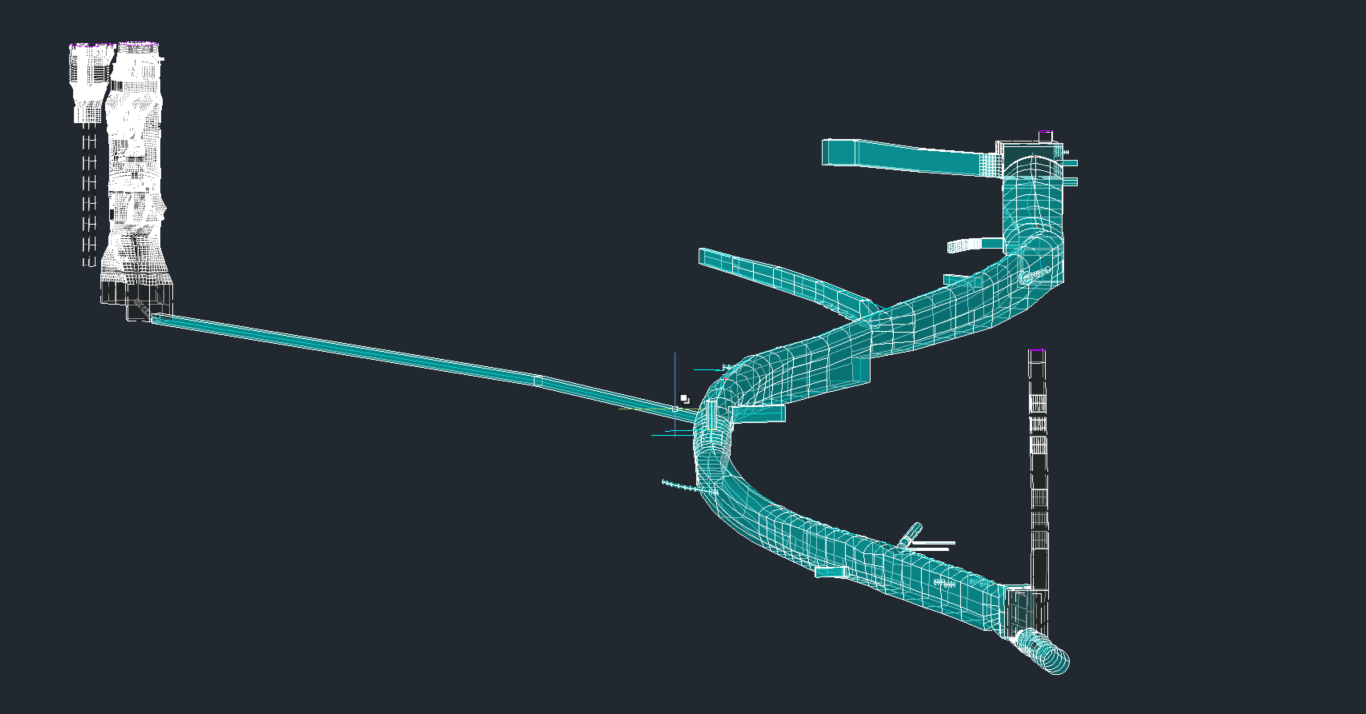
Photographic evidence and inverted scans ensured full spatial accuracy and thorough condition assessment. Deliverables included 2D and 3D AutoCAD drawings, point clouds, PDF reports, and a cloud-hosted platform linking images and video for ease of review and collaboration. 

Project benefits.

The survey provided a reliable technical and safety foundation, enabling confident development planning and protecting existing critical drainage assets.
01

Comprehensive Sub-Surface Understanding

Detailed positional and condition data ensured the underground structures were fully mapped and aligned with the design tolerances required for safe construction.
02

Enhanced Design Confidence

Accurate spatial models allowed the design team to visualise and integrate the culvert network within their planning workflows.
03

High-Quality Deliverables

Point cloud data and 3D models offered an immersive, measurable digital representation of the structures, supporting precision in decision-making.
04

Safety and Risk Mitigation

Through expert confined-space procedures and proactive weather and water-level monitoring, the project was completed without incident.

“Communication throughout the project was great."

“It was vital that we fully understood the location and depth of the underground structures as they were key to our development plans on site. The surveyors on site were highly professional and we were really impressed with the resulting model, especially when rotating the view to analyse the 3D section of the culvert. We will certainly use Plowman Craven again for other projects”

Design Engineer,

Major National Housebuilder

Project outcome.

The survey was completed on time and to specification, giving the client confidence to progress with development plans. The integrated approach delivered a robust dataset that confirmed the culvert, and wells were within acceptable tolerance levels, supporting both structural and environmental planning.

By combining advanced laser scanning, CCTV inspection, and specialist confined-space methods, Plowman Craven delivered accurate, reliable, and visually rich information while prioritising safety throughout the project.

Want to see more of our work?

Know more. Risk less. At every stage.

With 60 years' experience providing clarity for complex, high stakes projects, we'll deliver the insight you need to build better.