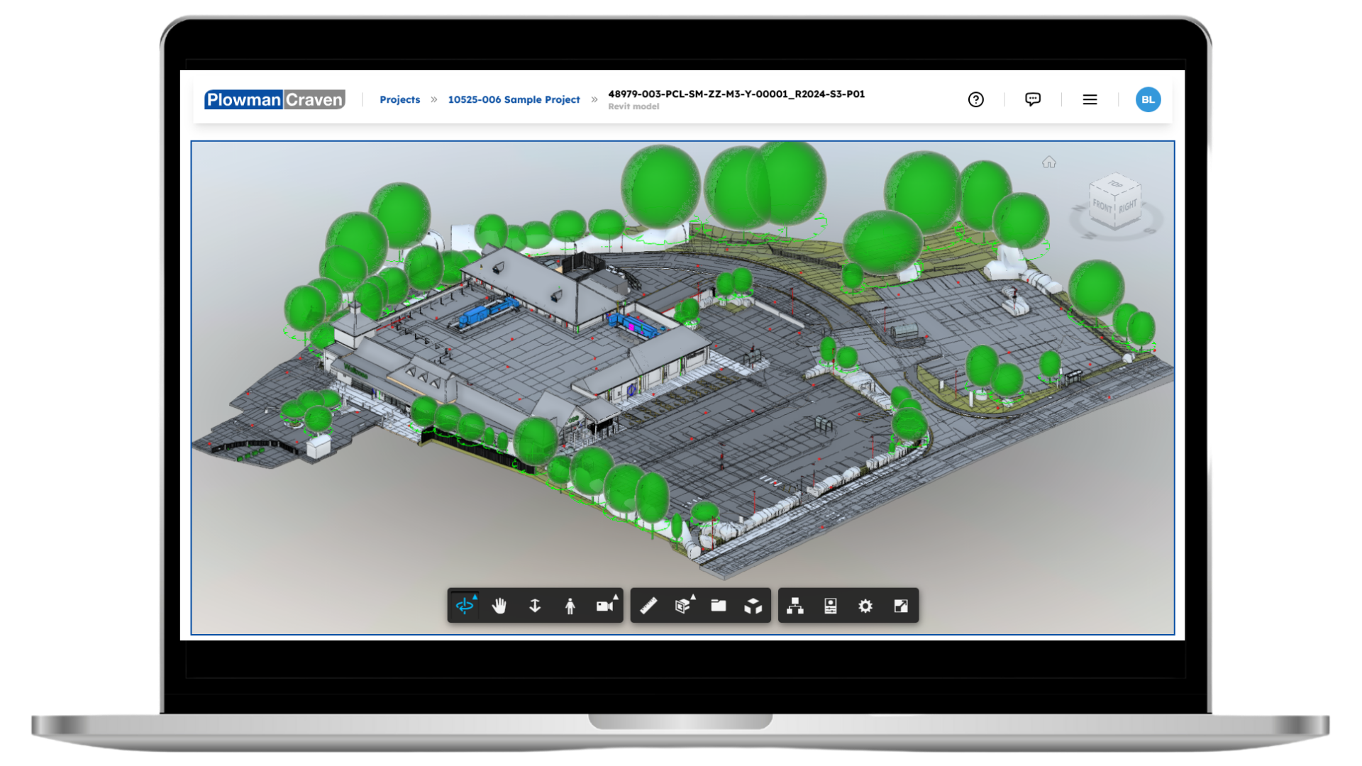
It’s your single source of truth. Designed to simplify decisions, improve coordination, and keep projects on track.
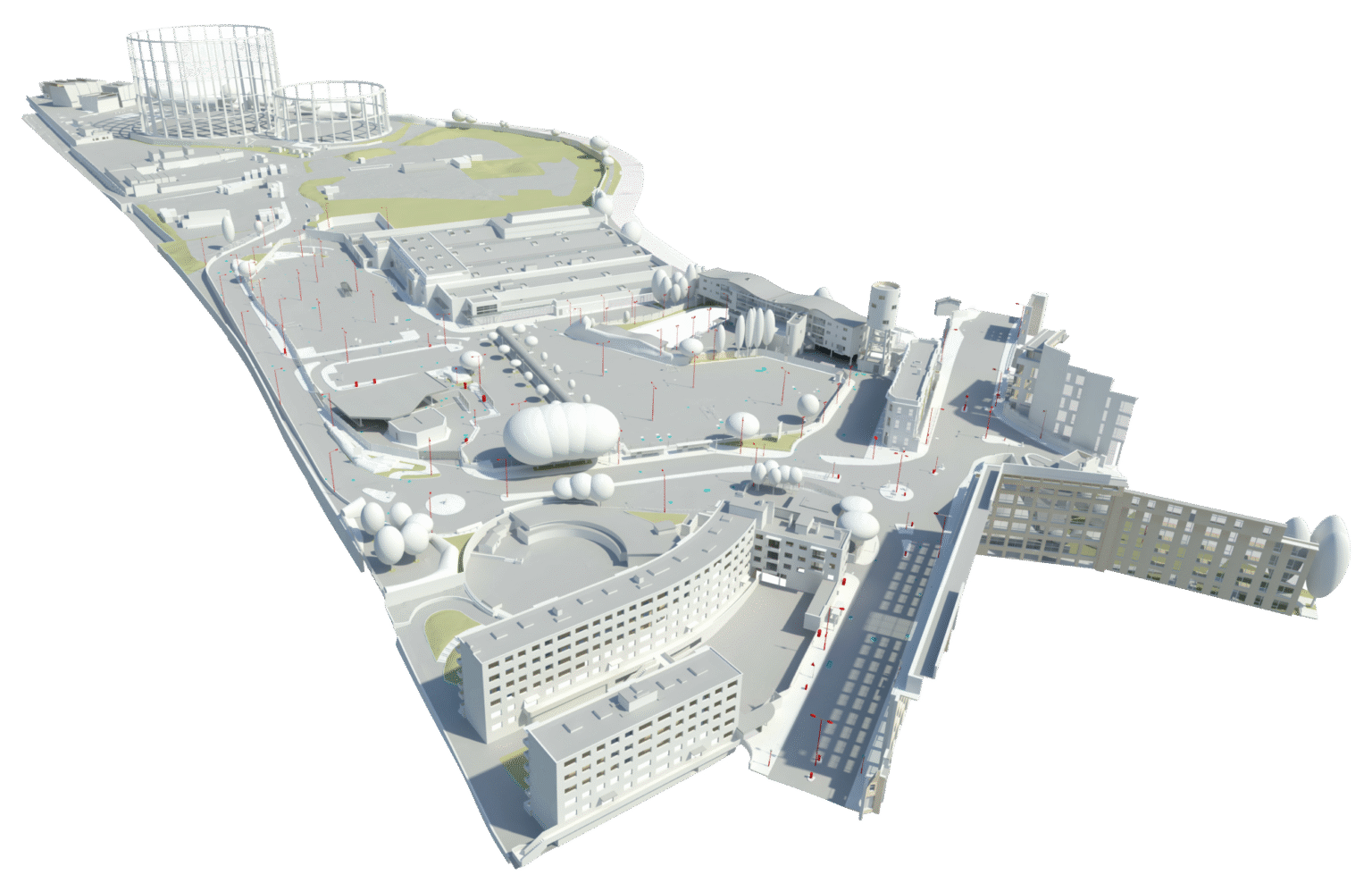
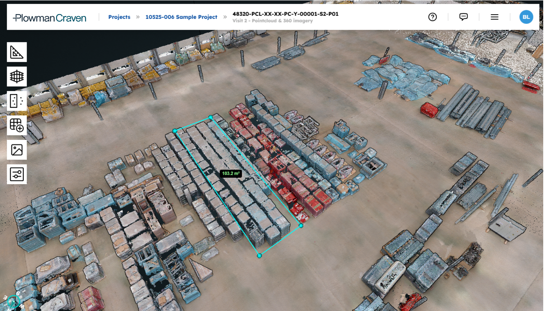
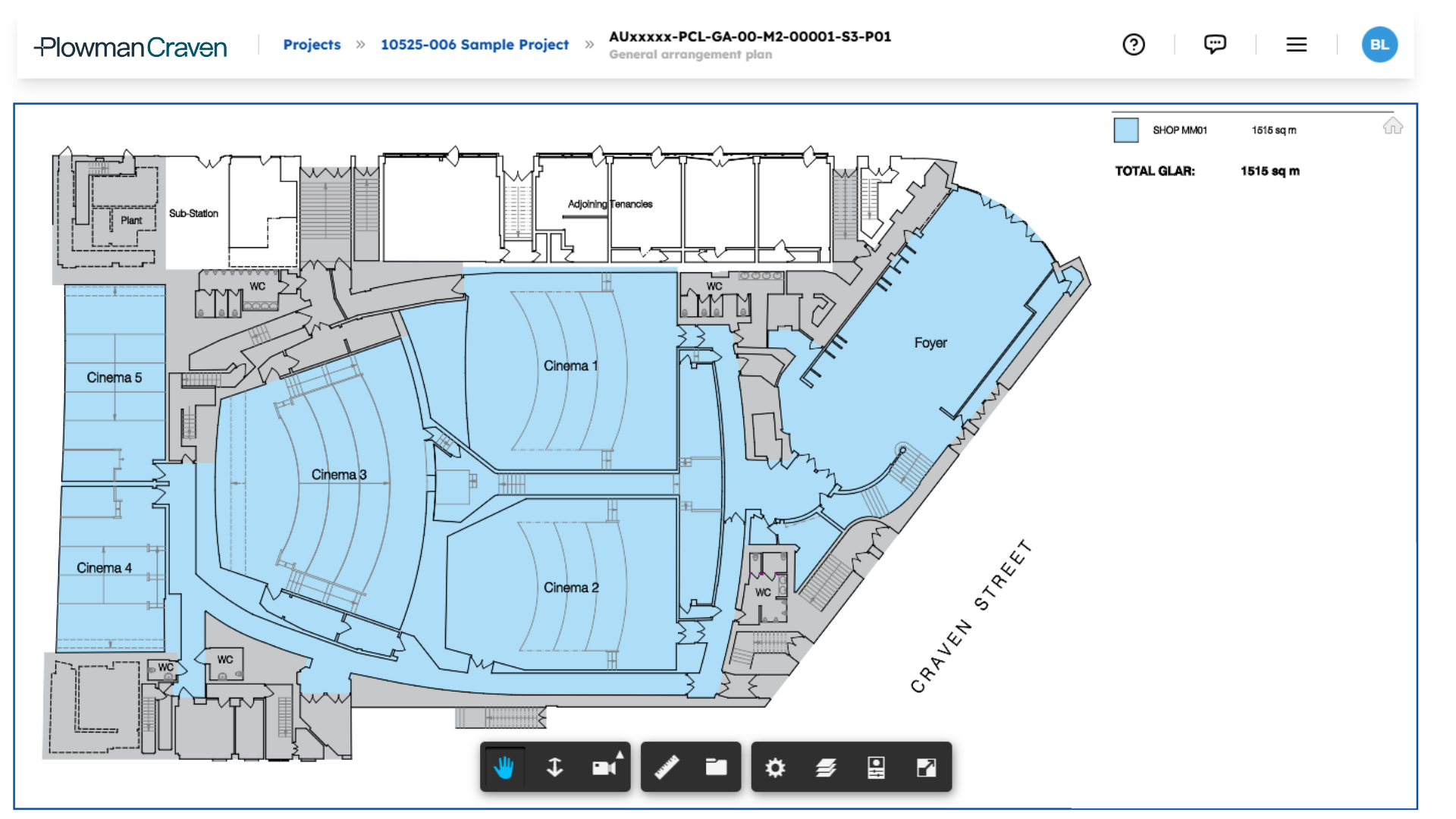
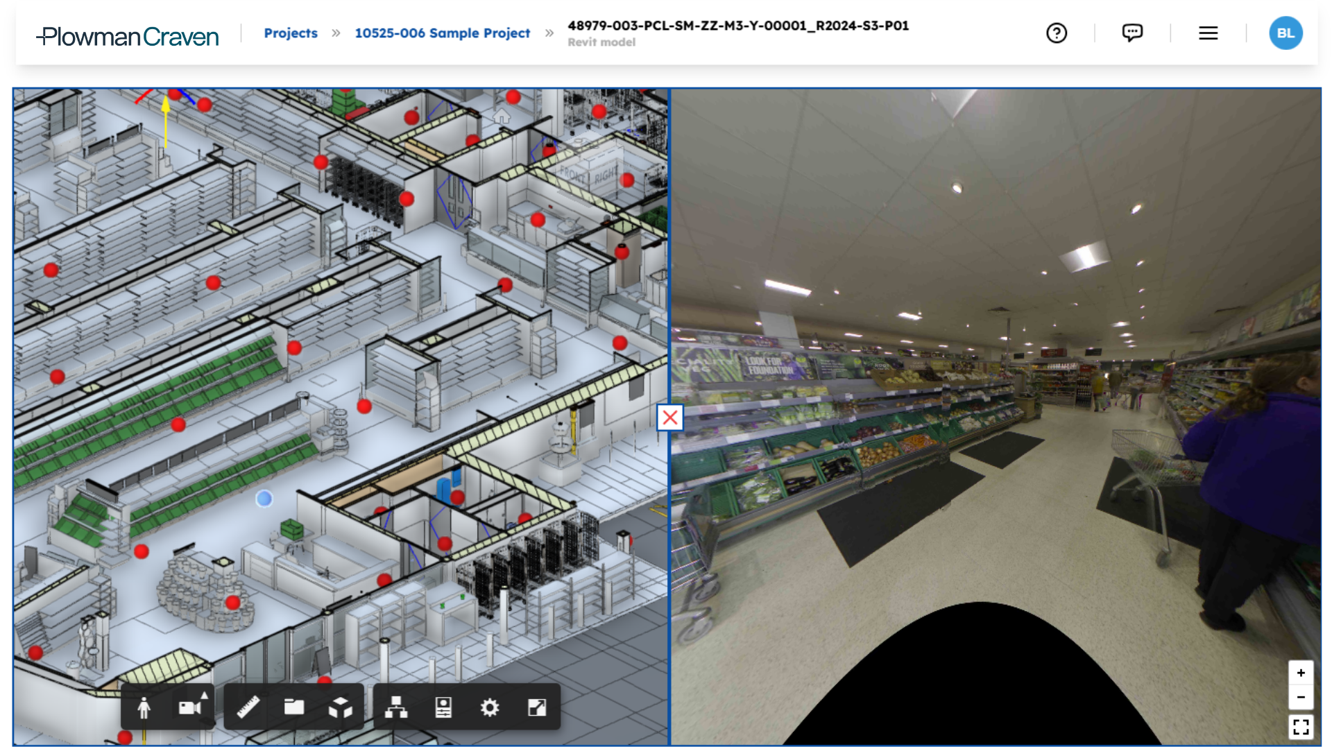
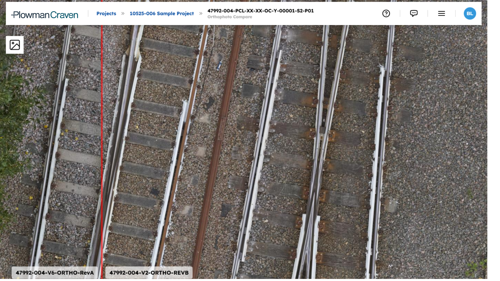
Bring BIM, point clouds, imagery, GIS and as-built records into one platform.
Explore data through intuitive, map-based 2D and 3D visualisation.
Share live links, control access and keep everyone aligned in real time.
Easily move structured data into your BIM or CDE systems.
Get rid of multiple tools. View, explore, and download every dataset in one secure environment and keep everyone up-to-date.
Always available, always protected. With custom permissions and access levels to give you complete control over who sees what.
Connects seamlessly with with major formats including CAD, BIM, LiDAR, and more. So information stays accurate, traceable, and up to date.
Carefully designed for effortless use by all teams. No technical expertise required.
Built in collaboration with clients like you. And continually refined by our survey, monitoring, and geospatial specialists.
Understand site constraints and collaborate in a shared digital environment.
Track site progress, validate works against design, and identify issues early.
Access live data to monitor asset condition and support long-term planning.
Access centralised project data for efficient decision-making from feasibility to completion.
Use real-time insights to optimise design, outcomes, and compliance.
Gain early visibility into site conditions and risks. Streamline planning and avoid delays.
Track performance, maintenance, and compliance across portfolios.
Easl supports collaboration and data-driven decision-making during design and construction. See it at work in our projects.
Let your data work harder,not you.